No car needed
Take the train
to the trail.
20 hikes you can walk to from 8 stations on 3 lines, and 16 more you drive to. Every figure links to its source.

All 36 hikes
36
Hikes mapped, 20 by train
8
Stations, 3 lines
27
With an official distance
5
Start at the platform
Shortest walk from the platform
Off the train, onto the trail

New York
Appalachian Trail: Cat Rocks (West Mountain)
7.0 mi—Out and backAppalachian Trail, starts at the platform

Hudson Highlands
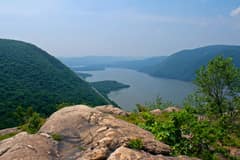
Arden Point
1.7 mi115 ftLollipopGarrison, starts at the platform
Hudson Highlands
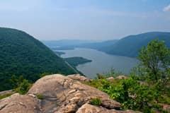
Bull Hill (Full Loop)
5.5 mi1,407 ftLoopCold Spring, 14 min walk
Hudson Highlands
Bull Hill (Short Loop)
4.6 mi1,191 ftLoopCold Spring, 14 min walk
Hudson Highlands
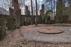
Cornish Estate Ruins
1.8 mi246 ftOut and backCold Spring, 14 min walk
Hudson Highlands
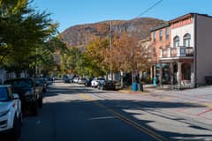
Little Stony Point Beach
0.7 mi92 ftLoopCold Spring, 14 min walk
Photos: Chenda Ngak, CC BY 3.0, via Wikimedia Commons; Daniel Case, CC BY-SA 3.0, via Wikimedia Commons; ScubaBear68, CC BY 2.0, via Wikimedia Commons; Reconrabbit, CC0, via Wikimedia Commons; Arwcheek, CC0, via Wikimedia Commons. Via Wikimedia Commons.
Weekend-only stops
Trains that stop for hikers
These stations only see service on weekends and holidays. Check the timetable before you go; a missed train can mean a long wait.
| Manitou | Weekends | Timetable |
| Appalachian Trail | Weekends | Timetable |
How we work
Sourced or blank
Every number on this site comes from a park, transit, or survey source and shows when it was last checked. When we do not have a source, the field says so instead of guessing. Trail lines are OpenStreetMap; elevation is USGS 3DEP.
MethodologyAbout
Hiking NY is a data site for hiking in New York
Trails in the Hudson Highlands, Harriman and Bear Mountain state parks and along the Appalachian Trail, marked by whether you can reach them from New York City by Metro-North or NJ Transit or need to drive. Each hike page has the map, the elevation profile, the blazes, the walk from the platform and the official timetable, and every figure links to the park or transit source that states it. Free GPX for every verified line. No accounts, no ads.